Basic Rangeland Types
The United States has 15 basic rangeland types that are economically important from the standpoint of forage production and total area.
Adapted from: Holecheck, J.L., R.D. Pieper, and C.H. Herbel. 1998. Range Management Principles and Practices, Third Edition.
Alpine Tundra
The highest range type in altitude is the alpine tundra which occupies those mountain areas above timberline that are characterized by short, cool growing seasons and long, cold winters. Low-growing, perennial, herbaceous, shrubby vascular plants dominate the vegetation along with cryptograms such as mosses (Selaginella sp.) and lichens (Cladonia sp.). Permafrost prevents the growth of trees. Alaska hosts the most alpine tundra in the United States, followed by Colorado, Washington, Montana, California, Oregon, Idaho, Utah, New Mexico, Arizona, and Wyoming. The 1,000 mm to 1,500 mm of precipitation occurs mainly as snow, and the land is constantly buffeted by winds and cold temperatures. Even during the growing season, air temperatures are often at or near freezing. These harsh conditions are very stressful to plants, and the flora is limited to 200 to 300 species that commonly occur in alpine tundra. Members of the bluegrass (Poaceae), sedge (Cyperaceae), saxifrage (Saxifragaceae), rose (Rosaceae), mustard (Brassicaceae), buckwheat (Polygonaceae), and pink (Caryophyllaceae) families have wide alpine distribution along with shrub species of the willow (Salicaceae) and heath (Ericaceae) families. Much of the alpine tundra has been designated as wilderness areas because of aesthetics, remoteness, and its importance as a water source in the western United States. Comparatively, livestock grazing ranks low in importance and is generally limited to sheep that are herded to minimize excessive use of rare, flat areas.
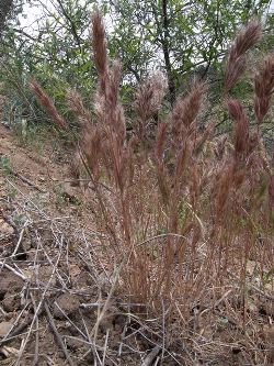
California Annual Grasslands
California annual grasslands are found primarily west of the Sierra Nevada Mountains. The climate of the region is Mediterranean, characterized by mild, wet winters and long, hot, dry summers. Rainfall varies from about 200 mm in the southern foothills to almost 1,000 mm in some areas near the coast. Most of the precipitation comes between October and May, with almost no precipitation during the summer months. Summers are hot and long, with an average frost-free period of 200 to 260 days. Soils vary across the region with only the less fertile areas remaining as rangeland.
The California annual grassland has one of the longest livestock grazing histories of the western range types, dating back to the Spanish settlements of the seventeenth century. Under pristine conditions, the California grasslands were quite beautiful, but they have suffered severe degradation since the arrival of European settlers. The original vegetation of the California annual grasslands was comprised of cool-season bunchgrasses; however, numerous fires and overgrazing from a very early date probably account for the change from perennial to annual grasses. Presently, less than 5 percent of the native perennial grasses remain. The cool-season annuals that replaced the perennial grasses have nearly ideal environmental conditions in California. This is because they have adequate moisture and temperature for growth and reproduction in winter while their seeds remain dormant during the dry summer period. Today, the vegetation is dominated by slender oat (Avena barbata), wild oat (Avena fatua), soft brome (Bromus mollis), ripgut brome (Bromus rigidus), foxtail brome (Bromus rubens), and little barley (Hordeum pusillum).
Because the grasslands of California are dominated by annuals, they have some unique problems. Generally, they are not very responsive to grazing intensity, although heavy grazing does cause erosion problems, some change in species composition, and reduced forage production. Season-long grazing has been superior to specialized systems. These ranges should be grazed lightly during plant germination and establishment in the fall, but grazing intensity can be increased substantially in the early spring. Primary problems in this type of rangeland include inadequate forage quantity in the fall and winter and inadequate forage quality in the summer. Forage quantity fluctuates drastically from year to year, necessitating operators to be able adjust their stocking rates rapidly or have a good reserve of harvested forage.
Cold Desert
The cold desert type, often referred to as the Great Basin, is comprised of two distinct vegetation communities, the sagebrush grassland and the salt desert. These two rangeland types intermingle with each other over vast portions of the intermountain United States (the area between the Cascade Mountains and the Rocky Mountains). Differences in vegetation and managerial components between the two cold deserts warrant a separate discussion of each.
Sagebrush grassland
Encompassing nearly 39 million hectares, the sagebrush grassland is one of the most extensive of the western range types. It covers parts of Oregon, Idaho, Nevada, Utah, Montana, Washington, and Wyoming, with about 65% of the land mass in federal control and 35% in private ownership. Compared to the salt desert, sagebrush grassland has higher precipitation and less saline soils and typically occurs at the higher elevations of the cold desert. Precipitation ranges between 200 mm and 500 mm. Summers are dry in the northern half of this range type, and most of the precipitation comes in the late fall, winter, and early spring as snow. In the southern part, most of the precipitation also comes in the winter, but slightly more precipitation comes in the summer. At higher elevations the growing season is often no more than 100 days. Soils are primarily volcanic material of the order Aridisols. Depth varies from shallow to deep, and topography is highly variable.
The dominant shrub of the region is big sagebrush (Artemisia tridentata). Important grasses of the sagebrush grassland are bluebunch wheatgrass (Pseudoregneria spicata), bottlebrush squirreltail, (Elymus elymoides), Idaho fescue (Festuca idahoensis), western wheatgrass (Pascopyrum smithii), Indian ricegrass (Oryzopsis hymenoides), needle-and-thread (Hesperostipa comata ), and basin wildrye (Leymus cinereus). Bluebunch wheatgrass dominates the understory in the northern half, with western wheatgrass dominating the understory in the southern half if grazing has not been abusive. Abusive grazing replaces the bunchgrasses with cheatgrass (Bromus tectorum) and increases sagebrush density.
Other important shrubs are rabbitbrush (Chrysothanmnus sp.) and antelope bitterbrush (Purshia tridentata). Sagebrush grasslands generally recover very slowly from overgrazing. Control of invasive and shrubby species can speed recovery.
The salt desert shrubland inhabits the lower areas of the Great Basin, where drainage is often restricted and the water table is high. This region occurs primarily in the states of Utah and Nevada as a mosaic with sagebrush grassland. The salt desert shrubland is one of the least productive of the range types because of climate and soils. Precipitation in the region ranges from 80 mm to 250 mm, the lowest precipitation of all types except the Mojave Desert. The xeric climate is exacerbated by the high salt content of the soil, produced when evaporation causes salts to accumulate at the soil surface. Generally, summers are quite dry with one-half of the precipitation falling as snow in winter and the remainder as rain in the spring or fall. Precipitation is highly variable from year to year, and there is very little vegetation growth in the dry years. Despite the cold winters and hot summers, the growing season is approximately 200 days. Soils are primarily Aridisols with varying degrees of alkalinity and salinity. Vegetation is characterized by a few species of low, spiny, grayish, and widely spaced microphyllous (small-leaved) shrubs in the Chenopodiaceae and Asteraceae families. Shadscale saltbrush (Atriplex confertifolia) dominates the area, with winterfat (Krascheninnikovia lanata) being the second most common shrub. Vegetation canopy cover is usually less than 10%. Much of the salt desert has historically been severely overgrazed, and vegetation recovery is slow but can be accomplished with moderate stocking rates. Traditionally, the range type was used as winter range for sheep which summer in the surrounding mountains. However, control of undesirable plants has not been economically feasible, enabling halogeton (Halogeton glomeratus), a poisonous forb to become dominant in much of the salt desert shrub.
Eastern Deciduous Forest
Although much of the eastern deciduous forest has been heavily modified by farming, logging, and industrialization, it is becoming increasingly important for livestock production. Many of these areas are managed using ecological rather than agronomic principles. The growing season lasts from 120 to 240 days, with snow and frost common in the winter. The 800 millimeter (mm) to 2,000 mm annual precipitation is uniformly distributed throughout the year. Soils of the order Alfisol support deciduous forest trees, including maples (Acer sp.), birches (Betula sp.), oak (Quercus sp.), hickories (Carya sp.), beeches (Fagus sp.), and basswood (Tilia sp.). Grasses such as bluestem (Andropogon sp., fescue (Festuca sp.), timothy (Phleum sp.), bluegrass (Poa sp.), brome (Bromus sp.), ryegrass (Lolium sp.), and orchardgrass (Dactylis sp.) thrive in open canopy areas where trees have been thinned or completely removed. Nitrogen and phosphorus fertilization can further boost forage production in the low fertility soils.
Hot Desert
The hot desert is one of the largest western rangeland types, yet compared to the other rangeland types, it is relatively unimportant from the standpoint of livestock production. This type is found in southern California, southern Nevada, Arizona, New Mexico, southwestern Texas, and northern Mexico. Elevations range from 925 m to 1,400 m. Precipitation in the desert climate varies from 130 mm to 500 mm and increases with elevation above sea level. Precipitation occurs primarily during winter, peaking in January and during summer with the wettest months being July, August, and September. May and June are extremely dry. Summer rains occur as convection storms because of solar heating. The frost-free period is generally over 200 days during the year, and it is not uncommon for areas to go two to three years without a killing frost. The Mojave Desert, Sonoran Desert, and Chihuahuan Desert occur in this type.
Vegetation of the hot desert type did not evolve with grazing by large herbivores; however, this area was one of the first types in the United States to receive grazing by domestic livestock. Severe overuse and lack of adaptation to grazing probably explain the large-scale decline of black grama and other climax grasses in the past 100 years. Almost all the plants found in the hot desert type are warm-season species. The warm, sunny climate of the Mojave and Sonoran deserts has attracted large numbers of people to these desert areas. Currently, tourism, wildlife, water, and recreation are the most important products of this rangeland type. Livestock grazing is still an important rangeland use in the Chihuahuan desert; however, large tracts of the Sonoran Desert are being converted into housing and other urban uses in Arizona. Management of livestock focuses on water development to improve livestock distribution and carefully adjusting stocking rates to forage availability. Recovery from overgrazing in these arid regions is often slow to non-existent.
Mountain Browse
The mountain browse range type occurs primarily in the Rocky Mountains and Sierra-Cascade Mountains of the western United States and is most prevalent in Colorado, Utah, Oregon, and Idaho. The climate is intermediate between that favoring grassland and that favoring forest, although at an average of 460 millimeters (mm) to 500 mm precipitation is not high enough to sustain forests. Temperatures range from 35°C in the summer to -34°C in the winter, with a growing season of 100 to 120 days. Soils are mostly Entisols and Inceptisols. The topography of the mountain browse type is variable, and elevations range from 1,200 meters (m) to 2,800 m. The ridges and dry, rocky slopes are dominated by shrubs 1 m to 10 m tall. Important species occurring throughout the type are chokecherry (Prunus virginiana) and several species of buckbrush (Ceanothus sp.). Gambel oak and true mountain mahogany (Cercocarpus montanus) are two of the most important shrubs associated with this type in the Southwest. The occurrence of antelope bitterbrush (Purshia tridentat) and other important forage species make this range type an important winter feeding area for big game.
Northern Mixed Prairie
The northern mixed prairie encompasses the western half of North and South Dakota, the eastern two-thirds of Montana, the northeastern one-fourth of Wyoming, and the southeastern part of Alberta and southern Saskatchewan in Canada. The climate is characterized by long, severe winters and warm summers. Average frost-free period ranges from about 140 days in the south to less than 100 days in Canada. Two-thirds of the 300 millimeters (mm) to 650 mm of average annual precipitation comes as rains during the summer, with the majority falling in June. Most soils are of the order Mollisols; however, much of the region is still rangeland due to the short growing season, drought, and severe winters. It is the second most important western range type from the standpoint of livestock production. The northern mixed prairie is home to the highest diversity of grasses of all the western range types, including short, mid-, and tall grasses, as well as cool- and warm-season grasses. Consequently, the northern mixed prairie is one of the best of all types for both wildlife and livestock from a nutritional standpoint. The diversity of grasses provides a continuous excellent feed source throughout the year: cool-season bluebunch wheatgrass (Pseudoregneria spicata) and various bluegrasses provide early spring feed; green needlegrass (Nassella viridula) and needle-and-thread (Hesperostipa comata), western wheatgrass (Pascopyrum smithii), and various forbs provide excellent late spring feed. Little bluestem (Schizachyrium scoparium), blue grama (Bouteloua gracilis), and sideoats grama (Bouteloua curtipendula)provide high-quality summer and fall forage, while the shrubs and blue grama provide excellent winter feed. Nevertheless, supplementation is often required for livestock during the winter because of frequent snow cover. The northern mixed prairie hosts the widest variety of shrubs of all the western range types. This is a primary reason why it supports an abundant and diverse wildlife population.
Oak Woodland
Rangelands dominated by oak species (Quercus sp.) can be divided into three categories: the shinnery oak (Quercus havardii) type found in southeastern New Mexico, west Texas, and south into Chihuahua, Mexico; the Gambel oak (Quercus gambelii) types in the central and southern Rocky Mountains; and the open savannah dominated by tree oaks in California, Oregon, southern Arizona, and central Texas. Oaks are sensitive to winter cold and occur primarily in areas with a maximum temperature near 36°C and a minimum temperature of about -34°C. Oak species occur on rolling uplands and foothills with a variety of well-drained soils. Precipitation in the oak woodland type ranges from 360 mm per year in the chaparral ranges of southern Arizona and New Mexico to around 1,000 mm per year in the California chaparral. In general, the size of the oak trees decreases in response to decreasing precipitation as one moves from the east to the west in the southern Great Plains.
Although most oaks have limited forage value for livestock, they are a valuable food source for many wildlife species. Deer, elk collared peccary, wild turkey, and other upland game birds forage on the acorns. Deer and elk also browse on the leaves of Gambel oak. The new growth of deciduous oaks such as shinnery and Gambel is poisonous to cattle and sometimes sheep, but goats can browse most oak species without harm and can even be used to control some oaks on rangeland. Oaks are sprouters, making control with herbicides and fire difficult. However, widespread control of oaks is not recommended. Rather, management should be focused on maintaining a mosaic of habitats to provide adequate forage for wildlife and livestock while preserving the aesthetic and ecological values of the oak woodland range type.
Palouse Prairie
The Palouse prairie occurs primarily in eastern Washington, north central and northeastern Oregon, and western Idaho. However, only remnants remain after the majority was converted into farmland. Soils are primarily loessal dunes in the order Mollisol. They have excellent textural, structural, and chemical properties for agriculture. Rainfall in the area ranges from 30 centimeters (cm) to 64 cm annually, with approximately 65% to 70% falling during the winter months. Peak precipitation occurs in December and January. The months of July and August have the lowest precipitation, although these months are wetter than in the California annual grassland type. The growing season lasts from 140 to 160 days, extending from May 10 to October 10. Winters in the Palouse country are relatively mild, and summer temperatures are seldom over 35°C.
The Palouse prairie is one of the most productive and beautiful grasslands in the world. The major characteristics distinguishing the Palouse prairie from other North American grasslands is that the climax vegetation is dominated by bluebunch wheatgrass (Pseudoroegneria spicata) or bluebunch wheatgrass and Idaho fescue (Festuca idahoensis). Grasses are almost entirely cool-season bunchgrasses because of the dry summers. The Palouse prairie supports a wide variety of forbs, most of them belonging to the Composite (Compositae) family.
The Palouse prairie grasses evolved with little grazing pressure from large herbivores. The American bison did not use this type because barriers such as the Rocky Mountains and Snake River Canyon restricted access. Both bluebunch wheatgrass and Idaho fescue have very low grazing resistance. For this reason, the Palouse prairie responds rapidly to overuse. The Palouse prairie was the first of the northern ranges to support a livestock industry. Unfortunately, overgrazing has resulted in an increase of downy brome (Bromus tectorum) and Sandberg bluegrass (Poa sandbergii) which can replace perennial bunchgrasses.
Pinyon-Juniper Woodland
One of the most widely distributed rangeland types in the western United States, the pinyon-juniper woodland (also spelled pinon-juniper), occurs from the state of Washington to 220 kilometers (km) north of Mexico City. Annual precipitation varies from 300 millimeters (mm) to 450 mm, with local areas receiving up to 500 mm. The frost-free period is variable and ranges from 91 to 205 days. Soils are poorly developed and are primarily of the orders Entisol and Aridisol. The climate is characterized by low precipitation, hot summers, high wind, low relative humidity, high evaporation rates, and much clear weather and intense sunlight, making it relatively harsh for tree growth. Nevertheless, a combination of overgrazing, absence of fires, dissemination of seeds by mammals and birds, and possibly climatic change has sparked tree encroachment onto grasslands and prompted original stands to become more dense. Overgrazing of understory species has reduced protective soil cover and resulted in severe soil erosion over much of this range type. As the tree overstory increases, perennial grasses and forbs decrease because of shading and increased competition from the trees. The pinyon-juniper woodland is one of the most depleted rangeland types occurring in the United States, particularly in the northern extent of the region, where very few areas presently support a good grass understory. Recovery from overgrazing is considered to be slow to nonexistent in most areas without control of the trees. Presently, wood from this type may have more economic value as a biofuel and carbon sink than the forage it provides for domestic animals.
Shortgrass Prairie
The shortgrass prairie extends from northern New Mexico into northern Wyoming, encompassing much of eastern Colorado. The low precipitation of the region (300 millimeters to 500 mm) has prevented cultivation, despite the fertile soils that are primarily Mollisols. Therefore, much of the region remains as rangeland. It ranks third in importance for livestock production among the western rangeland types. The climate is characterized by cool winters and warm summers, with the majority of the yearly precipitation coming from light rains falling throughout the summer. This climate favors warm-season grasses such as blue grama and buffalograss, which have shallow but extensive root systems. The region evolved under intense bison grazing, prompting the most abundant grass species to develop physiological and morphological adaptations to heavy grazing pressure. Livestock are generally grazed year-round on the shortgrass prairie with little hay provision; however, a protein supplement can substantially reduce livestock weight losses.
Winterfat is an important shrub that is palatable for livestock and wildlife and important for pronghorn antelope that thrive in this rangeland type. Scarlet globemallow is an important forb heavily used by cattle, sheep, and pronghorn. Throughout history, people have repeatedly attempted to cultivate portions of the shortgrass prairie, despite the fact that it will not sustain cultivation without irrigation and is subject to wind erosion.
Southern Mixed Prairie
The most important of the western rangeland types for livestock production is the southern mixed prairie, which extends from eastern New Mexico to eastern Texas and from southern Oklahoma to northern Mexico. The precipitation ranges from 300 millimeters (mm) to 700 mm across the region with a frost-free period generally at least 180 days in length. This vast area hosts a wide range of soils and climatic conditions that result in variable production and vegetation communities. There are four basic subtypes of the southern mixed prairie. These are: true mixed prairie, desert prairie, high plains bluestem, and oak savannah.
Soils of the region belong to the order mollisols, entisols, and aridisols. The southern mixed prairie has a long history of grazing, beginning with the buffalo and then domestic livestock brought in by the Spaniards in the 17th century. As a result, most grasses are relatively grazing resistant. Important grasses of the southern mixed prairie are: blue grama (Bouteloua gracilis), buffalograss (Buchloe dactyloides), little bluestem (Schizachyrium scoparium), various threeawn species (Aristida sp.) silver bluestem (Bothriochloa saccharoides), vine mesquite (Panicum obtusum), and sideoats grama (Bouteloua curtipendula). Texas wintergrass (Stipa leucotricha), is the only cool season grass of significance in the southern mixed grass prairie and as such provides an important winter feed source. Several woody invasive plants, such as mesquite (Prosopis sp.), create challenges for land managers and livestock producers over most of the southern mixed prairie, particularly when overgrazing occurs. Multi-species grazing is commonly used in this range type to increase animal production and improve range condition. The Merrill four-pasture, 30-herd grazing system appears to be more beneficial to soils, vegetation, and livestock and wildlife performance and health than continuous grazing.
Southern Pine Forest
The largest and most important rangeland type in the United States is the southern pine forest. With an annual precipitation of 1,250 millimeters (mm) and a frost-free period of 200 to 365 days, it is also the most important of all rangeland types for livestock production. The warm temperatures and large amount of precipitation ensure high vegetation production limited only by the acidic soils of the region. These highly leached soils are primarily of the order Ultisol.
Pine trees such as longleaf pine (Pinus palustris), shortleaf pine (Pinus echinata), and loblolly pine (Pinus teada) occupy much of the area and are grown for lumber. Most grazing occurs on open or cutover forests where grasses in the genera Andropogon, Panicum, Aristida, Paspalum, Sporobolus, and Cynodon provide abundant forage. Protein and phosphorus deficiencies in the forage require that livestock be supplemented for at least part of the year. Livestock production is second to timber production as the most important land use in the Southeast.
Tallgrass Prairie
The tallgrass prairie is located primarily in the central United States. Climate and disturbance have worked together to keep the area a grassland. Precipitation ranges from 500 millimeters(mm) in the north to 1,000 mm annually in the south, with most of it falling as rain in the summer growing season. Periodic summer drought combined with relatively frequent fires, every three to four years, prevented the successful establishment of trees. The subhumid, temperate environment coupled with the deep fertile soils (Mollisols) of the region make it ideally suited for cultivation. Consequently, much of the tallgrass prairie now grows wheat and corn. Very little rangeland still exists in this region and is confined to the Flint Hills of eastern Kansas and the Osage Hills of Oklahoma because of their thin, rocky soils unsuitable for cultivation.
The tallgrass prairie evolved under grazing by wild ungulates, primarily, the American bison. It is one of the most grazing-resistant range types, due to the high amount and favorable timing of precipitation. The tallgrass prairie is particularly well-suited for grazing in the summer and fall, but grasses become coarse and have little nutritional value to offer livestock during the winter months. However, extreme overgrazing can shift a tallgrass prairie from tallgrass prairie to mid-grasses to short grasses. A rotational grazing plan is recommended for the tallgrass prairie to optimize livestock performance and range condition.
Tallgrass prairie should be burned every two to three years in the spring to prevent excessive mulch accumulation. The most notable grass species of the tallgrass prairie are little bluestem (Schizachyrium scoparium), big bluestem (Andropogon gerardii), yellow indiangrass (Sorghastrum nutans), and switchgrass (Panicum virgatum). Important forbs of the tallgrass prairie are leadplant (Amorpha canescens) and scurfpea (Psoralea sp.). Buckbrush (Symphoricarpos orbiculatus) is the primary shrub on the tallgrass prairie, providing valuable food and cover for wildlife.
Western Coniferous Forest
Two main plant communities, ponderosa pine (Pinus ponderosa) and Douglas fir (Pseudotsuga menziesii)-aspen (Populus tremuloides), dominate the 33 million hectares that comprise the western coniferous forest rangeland type. Early adoption of good grazing management and high precipitation have prevented this forest from suffering the ecological damage seen in the pinyon-juniper vegetation type. The western coniferous forest supports many different land uses including recreation, watershed, wildlife, and scenic value in addition to livestock production.
As the largest of the true forest types in the western United States, ponderosa pine is found from inland California east to Nebraska and from southern Alberta south into northern Mexico. It is found at elevations between the pinyon-juniper and the Douglas fir zone ranging from 2,000 meters (m) to 2,500 m in the Southwest to as low as 1,100 meters in the northern areas. The ponderosa pine forest is also the most xeric forest type in the western United States receiving between 450 millimeters (mm) and 650 mm of precipitation, with most falling as snow in the north and as rain in the south. Frost can occur in any month of the year, and the growing season encompasses 105 to 140 days. The primary soils are Entisols with Inceptisols occupying the benchlands and ridges and Mollisols common in areas with more level topography.
Immediately above the ponderosa pine zone from 2,500 m to 3,100 m elevation is the Douglas fir-aspen forest. This forest type occurs primarily in Colorado, Idaho, Wyoming, Montana, Oregon, and Washington. The bulk of the Douglas fir-aspen forest type occurs in seral stages dominated by lodgepole pine (Pinus contorta) quaking aspen (Populus tremuloides) and western larch (Larix occidentalis). Soils in the region are primarily Alfisols, Entisols, and Inceptisols, and the topography is very steep. The growing season lasts from 100 to 125 days, and the zone receives 640 mm to 900 mm of precipitation falling mostly as snow.

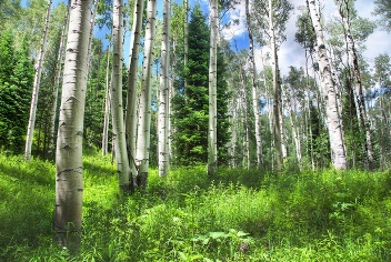
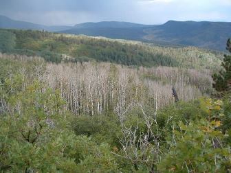 SAD) initiated by drought. For decades we have been hearing about great losses in aspen coverage in the western states due to advancing conifer succession. Some of these changes were caused by past management practices, such as fire suppression and active removal of aspen or management for higher value conifer timber species. More recent evidence, however, suggests that a regionally moist 20th century generally kept fire events limited, allowing conifer expansion and aspen decline. In other locations, aspen actually expanded its range so we must be careful not to oversimplify regional patterns. This interaction with conifers does not explain losses in stable (nearly pure) aspen forests. Thus, we must understand at least two aspen "types" which depend on different ecological mechanisms to persist.
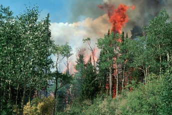 an aspen clone rapidly regenerates after all types of disturbance (i.e., landslides/avalanches, insects, disease, drought, tree harvest) including burning. Moreover, recent discoveries of high genetic diversity in aspen communities and common occurrences of seedling (sexual reproduction) establishment following fire is leading practitioners to question traditional aspen management. Fire suppression during recent decades is thought to be partially responsible for long-term aspen decline, however several experts have questioned this assertion. Likely, there are several causes for the lack of fire, most notably long periods of climatic moisture that increased the number of conifer trees in some aspen forests over the past century. Stable (nearly pure) aspen is much less conducive to wildfire or prescribed burning; rejuvenation in these forests is dependent on more continuous, low-level, tree mortality and regeneration.
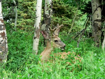 Young aspen sprouts are particularly favored by deer, elk, cattle, and sheep for their highly nutritious leaves and twigs. During the late summer and early autumn aspen may be the only green, nutritious, component of forests available as forage. Fortunately, aspen leaves contain defense compounds (phenolic glycosides and condensed tannins) that may deter herbivores, at least partly, from devouring young suckers. However, with high animal concentrations—often a mix of wild and domestic herbivores on the same landscape—defense mechanisms may not sufficiently deter browsing on regenerating aspen suckers. If these consumption patterns persist over many years aspen forests begin to lose their age and structural complexity. This situation seems particularly serious is stable (nearly pure) aspen forests where uncommon large disturbances offer little hope of broad forest rejuvenation.
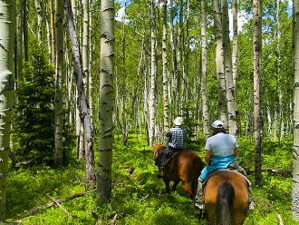 its apparently innate beauty; a rich gold or fluttering green among the sea of conifer and sagebrush. Utah recently recognized aspen as its State Tree largely on the basis of esthetic appeal. Digging a little deeper, however, we can tap into, perhaps even monetize, other aspects of aspen worth. For example, aspen is among the most biodiverse vegetation types in the Intermountain West. Additionally, range managers are well aware of the high value forage resident among aspen groves. A diverse array of wildlife utilize aspen for cover, food, habitat, and water. There is some evidence that healthy aspen communities facilitate water conservation. Thriving beaver colonies create migrating water retention ponds, as well as raising water tables and increasing wildlife habitat. Aspen is valuable for a variety of wood products, including flooring, mine supports, particleboard, pet bedding, excelsior (wood fiber packaging and cooling devices), and ski/snowboard manufacturing. Aspen forests make for cherished camping and recreation destinations, popular ski resorts, and general tourism promotion. Finally, aspen may be used as a fire break via selective cutting or light burning around developed areas.What is the value of aspen? Ask any westerner if they could go without it. License: Creative Commons 2.0 (by-nc-sa)
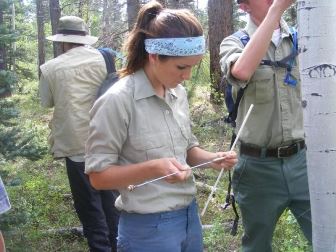 sprouting response is not enough to protect from post-treatment browsers. In order to sustain aspen on the landscape land stewards are adopting "resilience management" strategies. In essence, this entails preserving options. Where fire was historically an important regenerative tool in seral aspen, judicious use of selective harvest practices and prescribed and wildlife fire management may be invoked. A key component of resilience management means understanding ecological function: not all aspen stands are alike in terms of their ecology and earlier human impacts. Treating aspen as a "one-size-fits-all" prospect may cause irreversible damage. Thus, locally-based knowledge, current science, ongoing monitoring, course correction (where necessary), and institutional support—all key elements of "adaptive management"—provide a recipe for resilience. The complexity of resilience management will require multiple perspectives if they are to be successful.